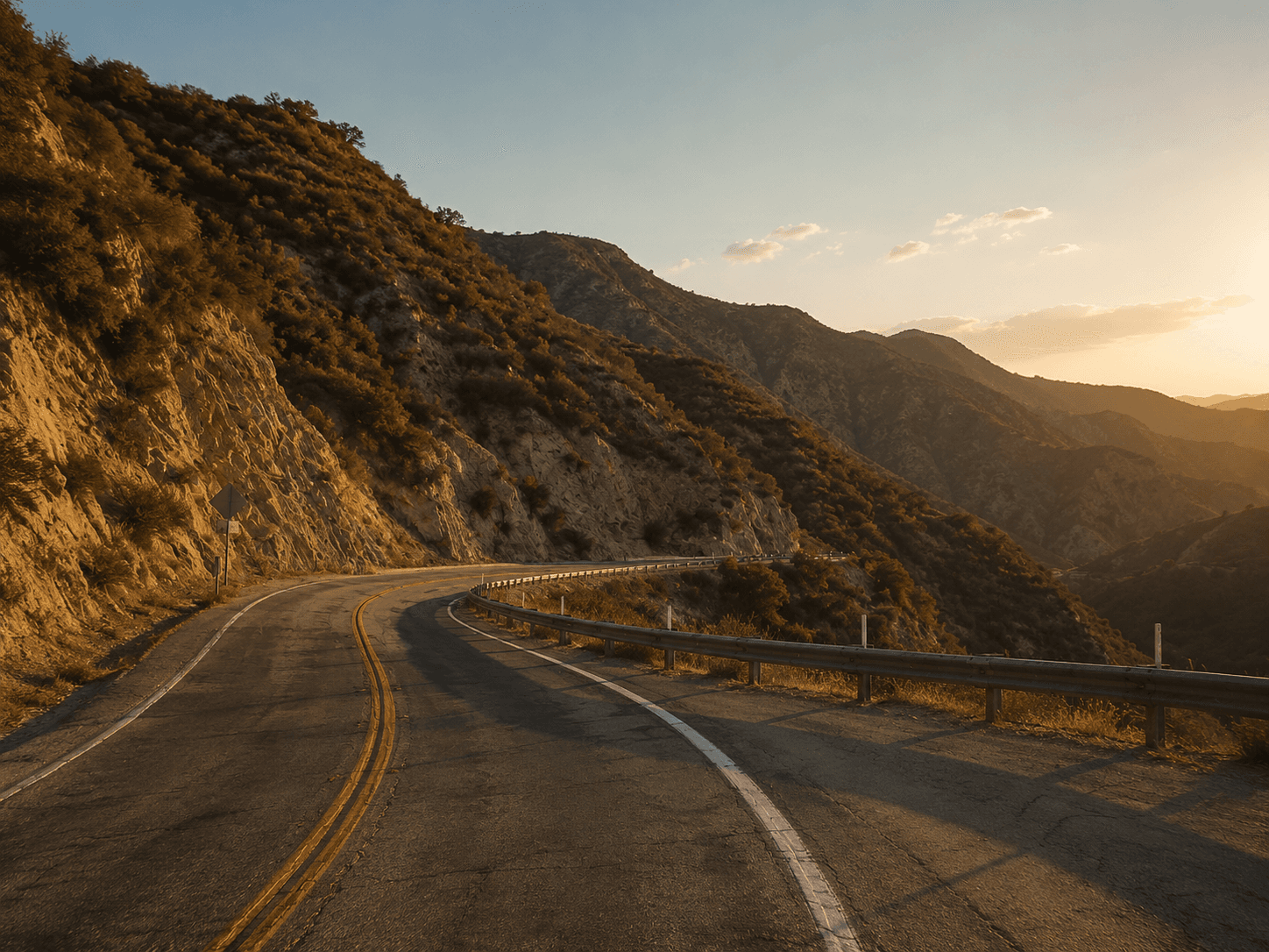
Angeles Crest Highway
Sixty six miles of the best mountain road in Los Angeles, from La Cañada up past Mt Wilson into the San Gabriels. Dawn drivers, golden hour photographers, and a canyon the CHP work hard.
Dawn is your best shot at a clear road. By mid-morning on a weekend, expect a parade. CHP work this canyon hard, and they ticket for speed and for the donuts people cut at the turnouts. People regroup at the Newcomb’s Ranch pull-out and the Clear Creek vista. The top half shuts for snow most winters, and storm repairs can keep it closed for months, so check before you count on a full run.
- A 66 mile mountain run into the San Gabriels
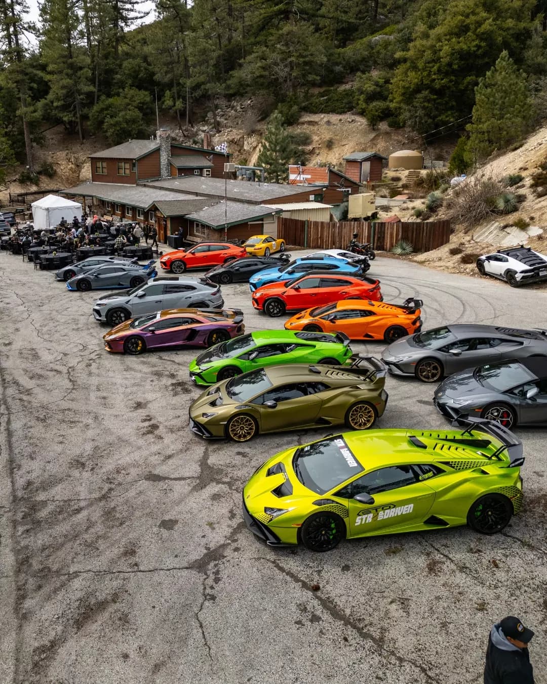
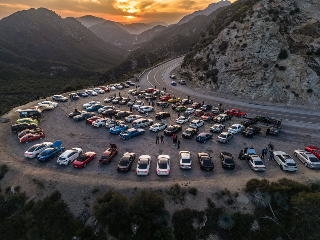
- Golden hour gatherings at the scenic turnouts
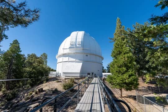
- Newcomb's Ranch, the historic roadhouse stop
- Dawn drives before the weekend crowds
- Tight, technical canyon corners
- Dawn for a clear, empty road
- Golden hour for the turnout gatherings
A few hours for the run and stops
State Route 2 from La Cañada Flintridge over the San Gabriel Mountains toward Wrightwood. Free, 24/7 except seasonal and weather closures. Newcomb's Ranch is the traditional stop.
Spring through fall in daylight; upper segments gate-close for winter snow, often December through April.
Heavy weekend recreational traffic — motorcyclists, cyclists, and sightseers.
Long, sweeping mountain highway climbing near 7,900 ft. Rockfall and fire-repair zones are common and upper sections close for snow. Check Caltrans QuickMap before heading up.
Drivers and photographers gather at the scenic turnouts near Newcomb's Ranch, especially the pull off known as Scenic Turnout #2, for the weekly golden hour meet. Park nose out for the view west.
A working mountain highway shared with through traffic, motorcycles, and cyclists. Quiet and clear at dawn, a parade by mid morning on weekends.
CHP work this canyon hard and ticket for speed. The turnouts are narrow and shared, so pull fully clear of the travel lane and watch for traffic.
The 66-mile run from La Cañada Flintridge up into the Angeles National Forest. Built in the 1930s as a way to reach the high country, it climbs past Mt Wilson, Charlton Flat, and the ski areas before topping out near Wrightwood. Tight in places, fast in others, with weather that turns cold above 5,000 feet. CHP work it hard on weekends. The classic LA dawn run.